Teacher Portal:
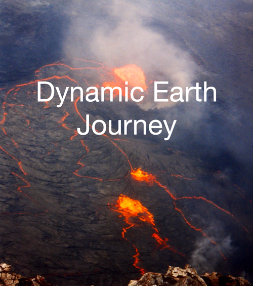
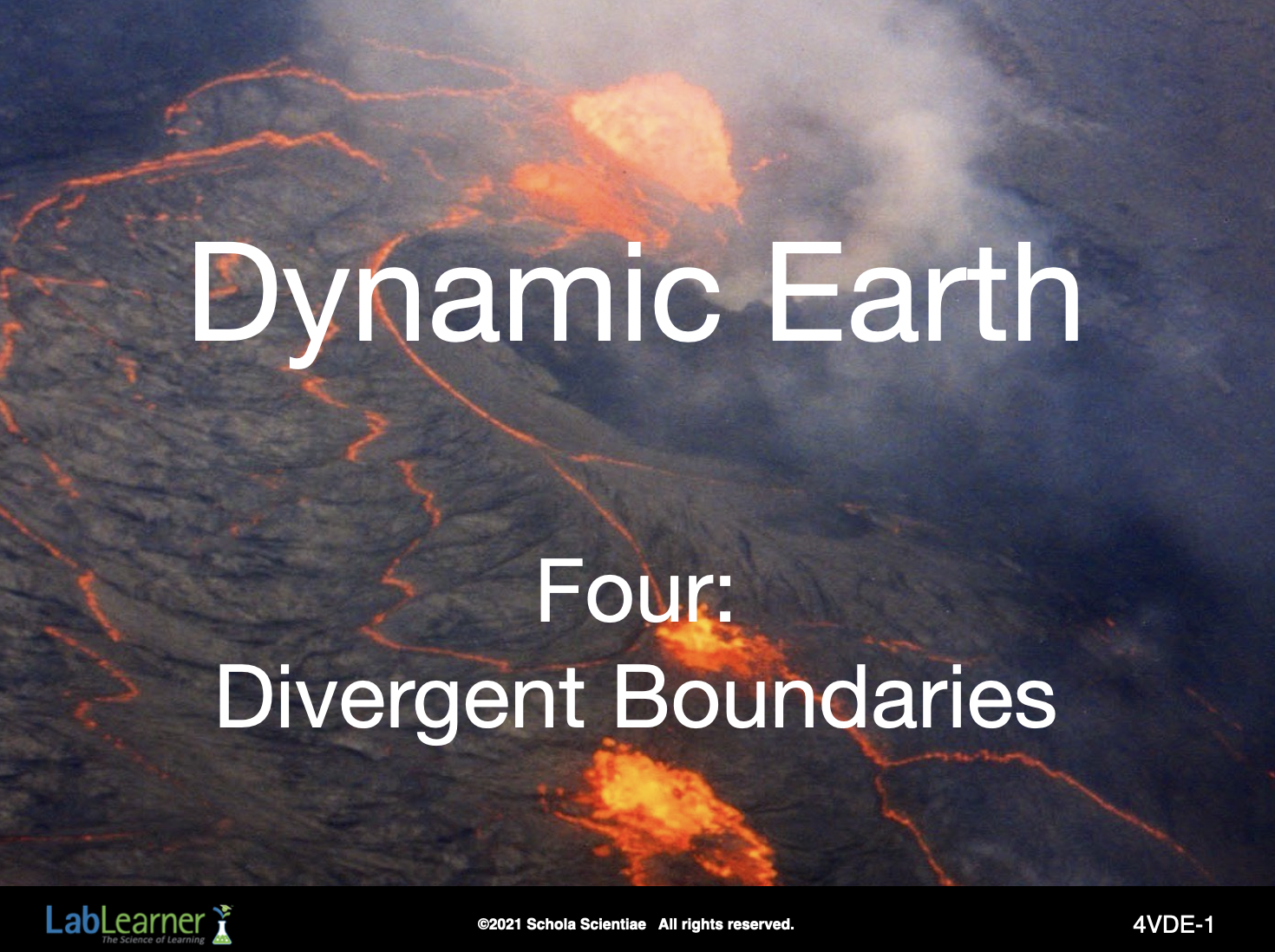
Dynamic Earth Journey
Four: Divergent Boundaries
 PRINT IT
Use your browser to download a printable PDF as help during the slide presentation and to make additional notes. In your browser, go to File > Print and then choose to save as PDF.
NAVIGATE IT
Once the slide presentation is launched
- use your left and right arrows to advance or go back in the slide presentation, and
- hover your mouse over the left edge of the presentation to get a view of the thumbnails for all the slides so that you can quickly move anywhere in the presentation.
- Click HERE to launch the slide presentation for the CELL.
SHARE IT
SLIDE 4VDE-1
______________________________________________
SLIDE 4VDE-2
Teacher Notes:
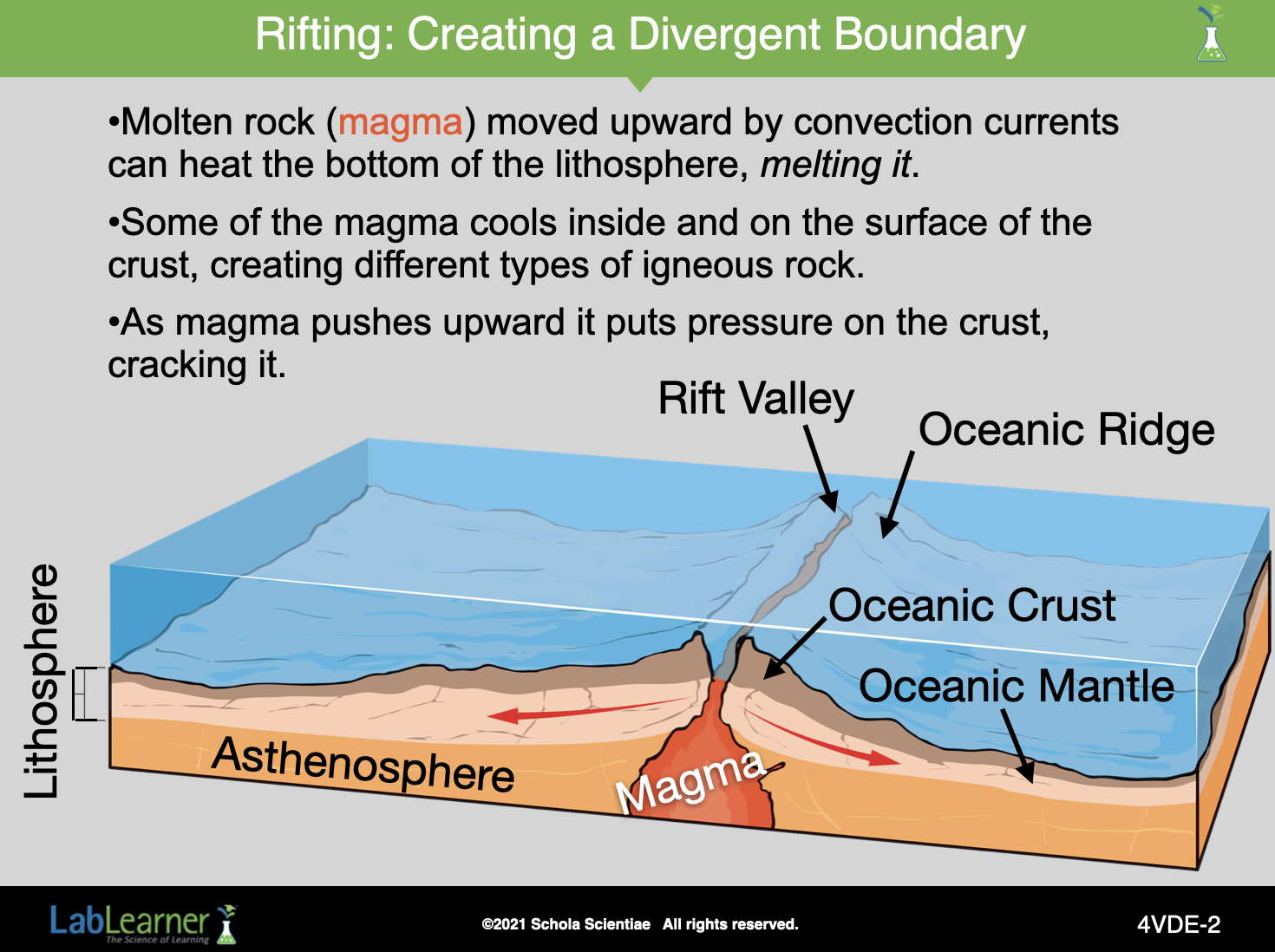
Rifting occurs because there are points in some places of the Earth’s lithosphere where the rising molten rock creates a hot spot. That is, it heats, expands, and melts the bottom of the lithosphere. Because certain conditions such as the type of rock and thickness of the lithosphere need to be in place, it doesn’t happen everywhere in the lithosphere. But it does happen.
When a hot spot forms, the lithosphere is heated and expands. As the lithosphere expands, magma can move from the mantle to the surface of the Earth. As more and more magma enters the lithosphere, it causes the lithosphere to swell and stretch to the point at which some of the Earth’s crust cracks.
As the magma flows upward, it creates new crust on the surface of the Earth.
As the crust cracks, the area between the two sides of the cracking crust sinks into the mantle. As a result, earthquakes occur along the rift.
Magma rises up through cracks creating volcanoes. If enough pressure is exerted by the magma, the two sides of the crust can pull completely away from each other creating two new tectonic plates.
______________________________________________
SLIDE 4VDE-3
______________________________________________
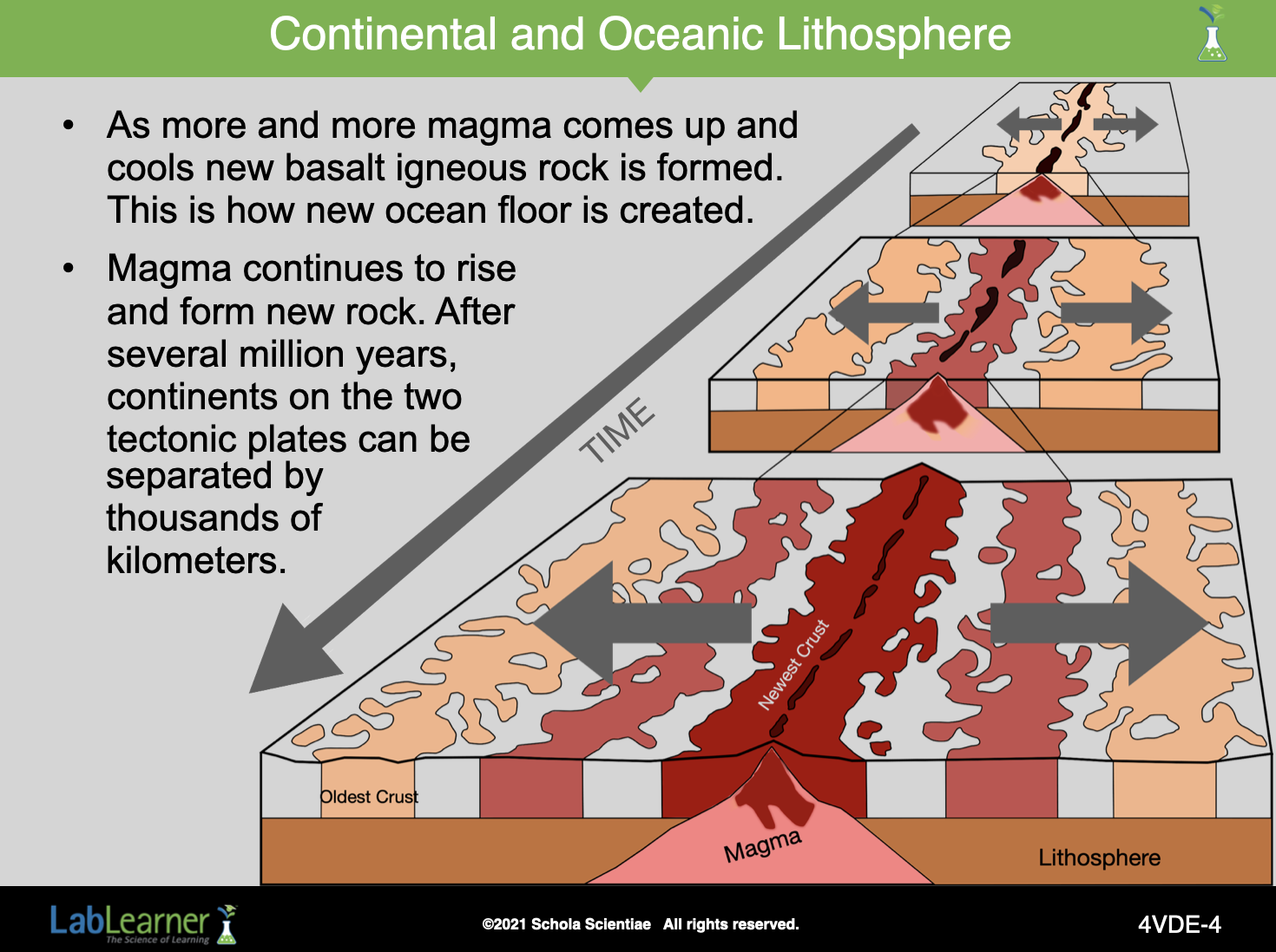
SLIDE 4VDE-4
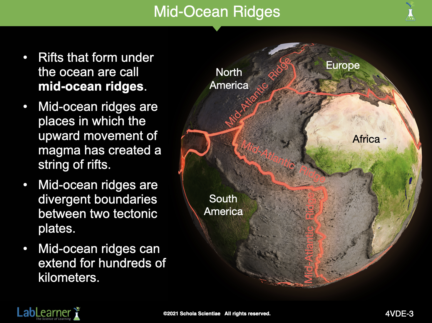
The process of magma rising and forming new rock along the two sides of a mid-ocean ridge is called seafloor spreading.
As the floor spreads, continents located on either side of the divergent boundary move farther apart, allowing the ocean to expand in width.
In some locations, rift valleys along the Mid-Atlantic Ridge are over 10 kilometers wide.
______________________________________________
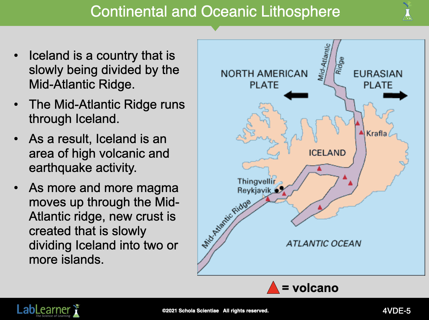
SLIDE 4VDE-5
As we have already seen, the Mid-Atlantic Ridge runs through Iceland. Some parts of the ridge are exposed and can be seen on land as huge rifts or valleys. In the area around Thingvellir, there are deep valleys as the center of the rift drops into the surface of the Earth. In other places, the rift is apparent as volcanoes. All of the red triangles illustrate the active volcanoes on the island.
The formation of Iceland was the result of volcanic activity along the Mid-Atlantic Ridge. Eventually, as the lithosphere continues to stretch and sink, the rift valleys will fill with sediment and water. This will turn the rift valley back into an ocean basin across the Ridge.
______________________________________________
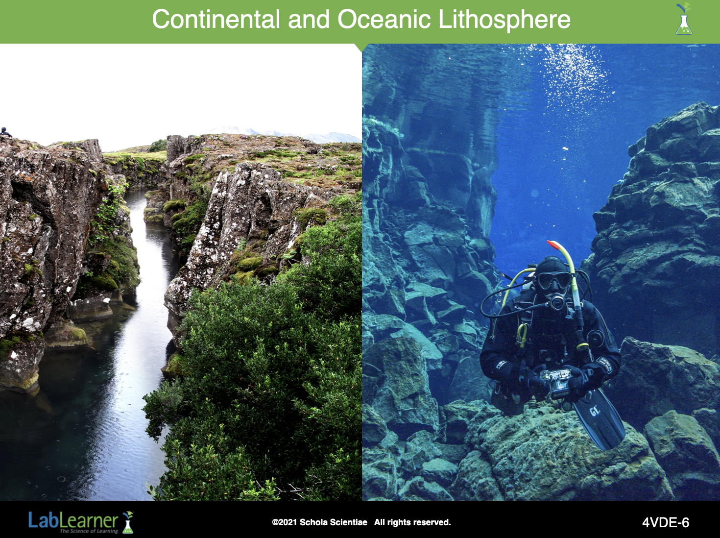
SLIDE 4VDE-6
We have seen a similar slide before. On the left is seen the continental rift in Iceland’s Thingvellir Rift Valley.
The rift valley, which is formed along the North American/Eurasian divergent boundary (the Mid-Atlantic Ridge, shown again in slide #3 above), continues south into the North Atlantic Ocean, where it continues for another 16,000 km (10,000 miles)!
______________________________________________
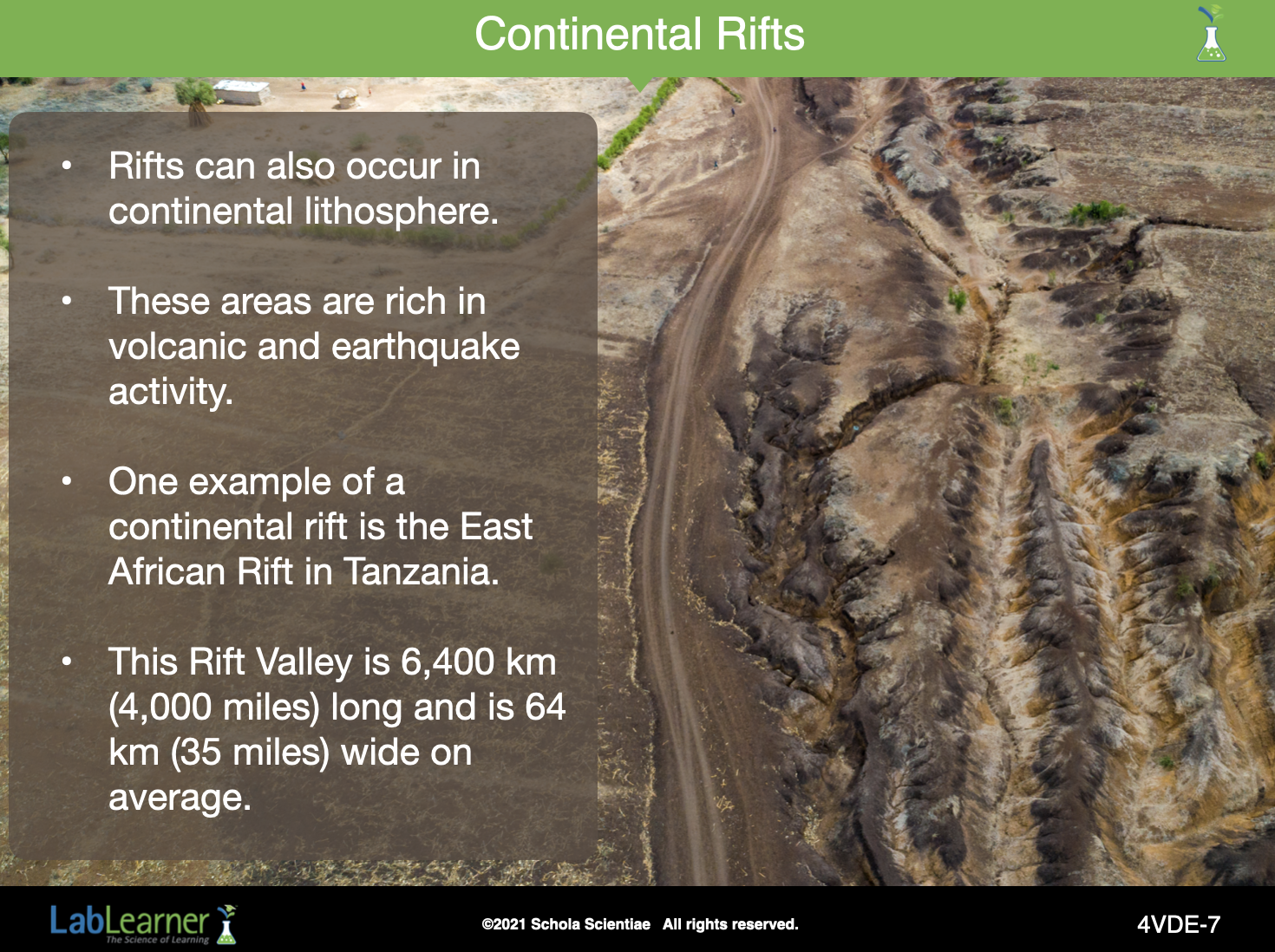
SLIDE 4VDE-7
______________________________________________
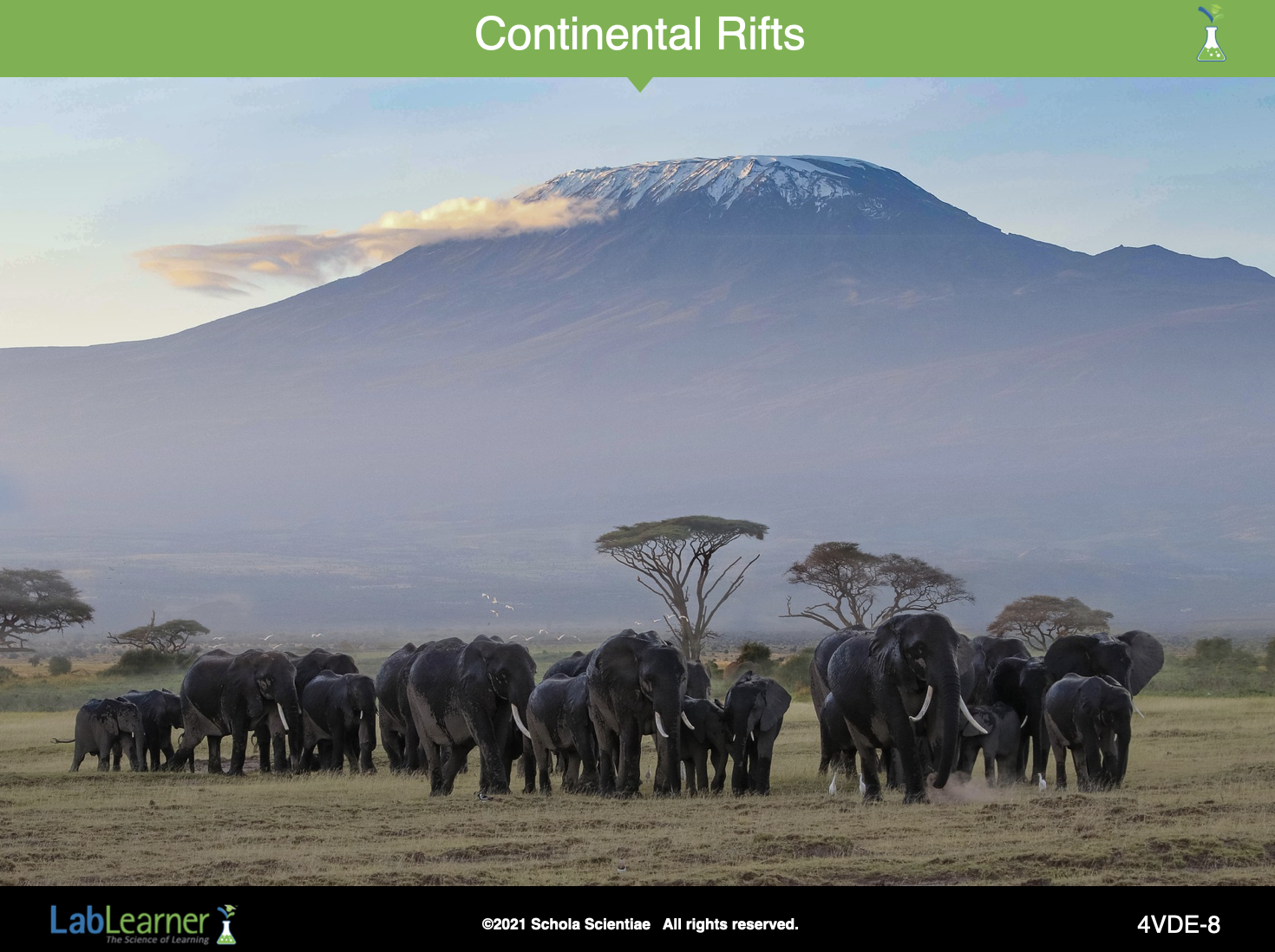
SLIDE 4VDE-8
This picture shows a volcano in the East African Rift zone. This section of land would be lower than surrounding areas as it has started to sink into the mantle. The mountain in the background is Mt. Kilimanjaro, one of the volcanoes in this rift zone.
Mount Kilimanjaro is Africa’s tallest mountain at 5,200 m above the surrounding plains. It is also the world’s highest free-standing volcano. Kilimanjaro, as well as several smaller volcanos near it, formed along the rift valley as a result of the lithospheric divergent motion.
______________________________________________
SLIDE 4VDE-9
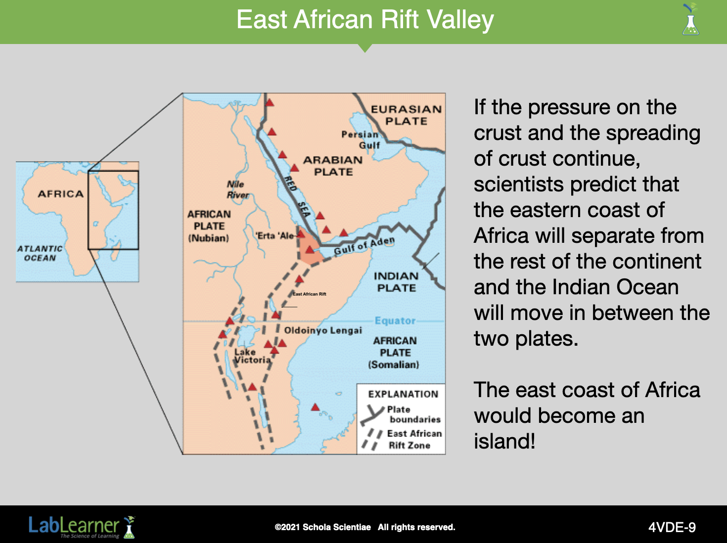
This picture shows a volcano in the East African Rift zone. This section of land would be lower than surrounding areas as it has started to sink into the mantle. The mountain in the background is Mt. Kilimanjaro, one of the volcanoes in this rift zone.
This diagram illustrates the East African Rift zone in relation to all of the other tectonic plates. If the spreading of the crust continues at the East African Rift zone, the African Plate will be split and a brand new divergent boundary formed between the east coast of Africa and the rest of Africa.
______________________________________________
SLIDE 4VDE-10
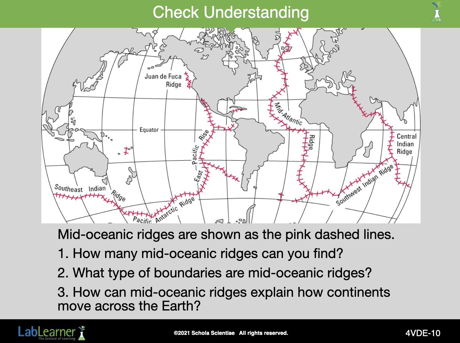
Answers to questions:
- There are 9 mid-oceanic ridges. The Southeast Indian Ridge, Pacific Antarctic Ridge, East Pacific Ridge, Juan de Fuca Ridge, Mid-Atlantic Ridge, Southwest Indian Ridge, Central Indian Ridge, one un-named ridge off the coast of Mexico, one un-named ridge off the coast of Australia.
- Mid-oceanic ridges are divergent boundaries.
- Mid-oceanic ridges are places in the ocean lithosphere (ocean floor) in which magma has pushed up into the lithosphere. In doing so, it has caused a rift in the ocean floor and formed a series of volcanoes. As more and more magma rises up through the rift (volcanoes), it spreads on either side of the rift pushing the two sides of the rifts or two tectonic plates apart and building new oceanic lithosphere or ocean floor in the space between the volcano and the sides of the tectonic plates. As more new ocean floor is created, the tectonic plates on either side of the rift continue to move farther apart. Because continents exist as the land masses on these tectonic plates, the continents move across the surface of the Earth.
______________________________________________
SLIDE 4VDE-11
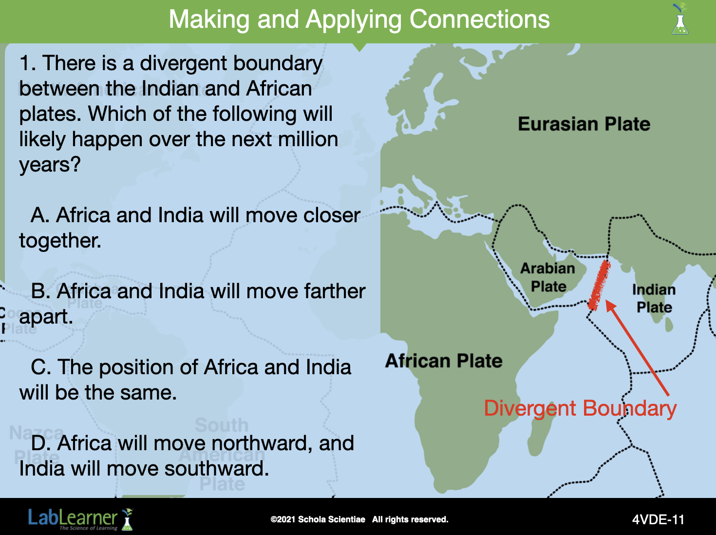
Answer
Question 1: B
______________________________________________
SLIDE 4VDE-12
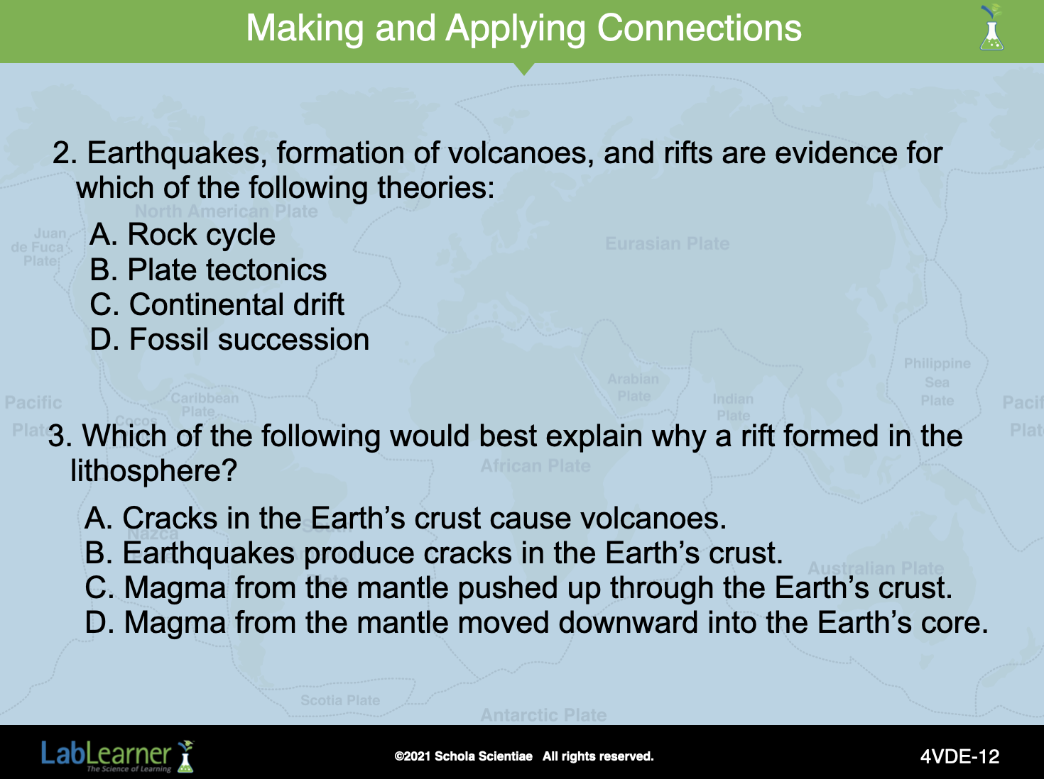
Answers
Question 2: B
Question 3: C
______________________________________________
SLIDE 4VDE-13
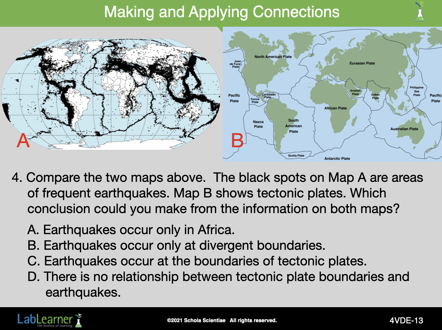
Answer
Question 4: C
Image credits: Earthquake locations map, from A, retrieved on August 14, 2016 from https://commons.wikimedia.org/wiki/File:Quake_epicenters_1963-98_notitle.png [Public Domain]
______________________________________________
SLIDE 4VDE-14
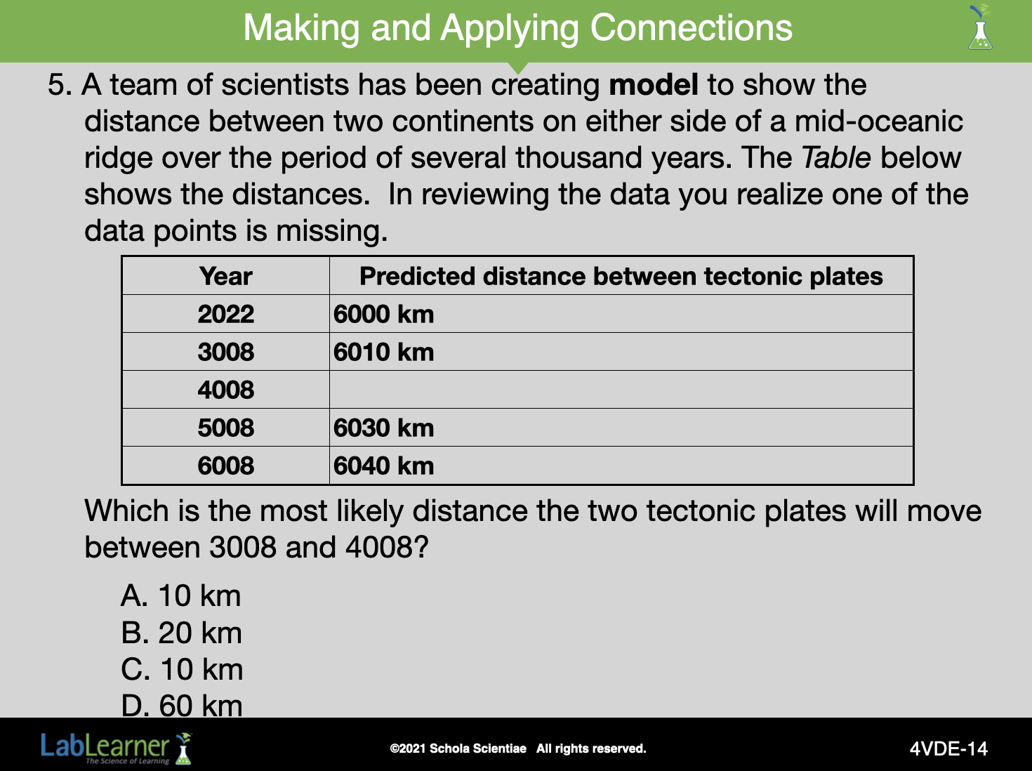
Answer
Question 5: C